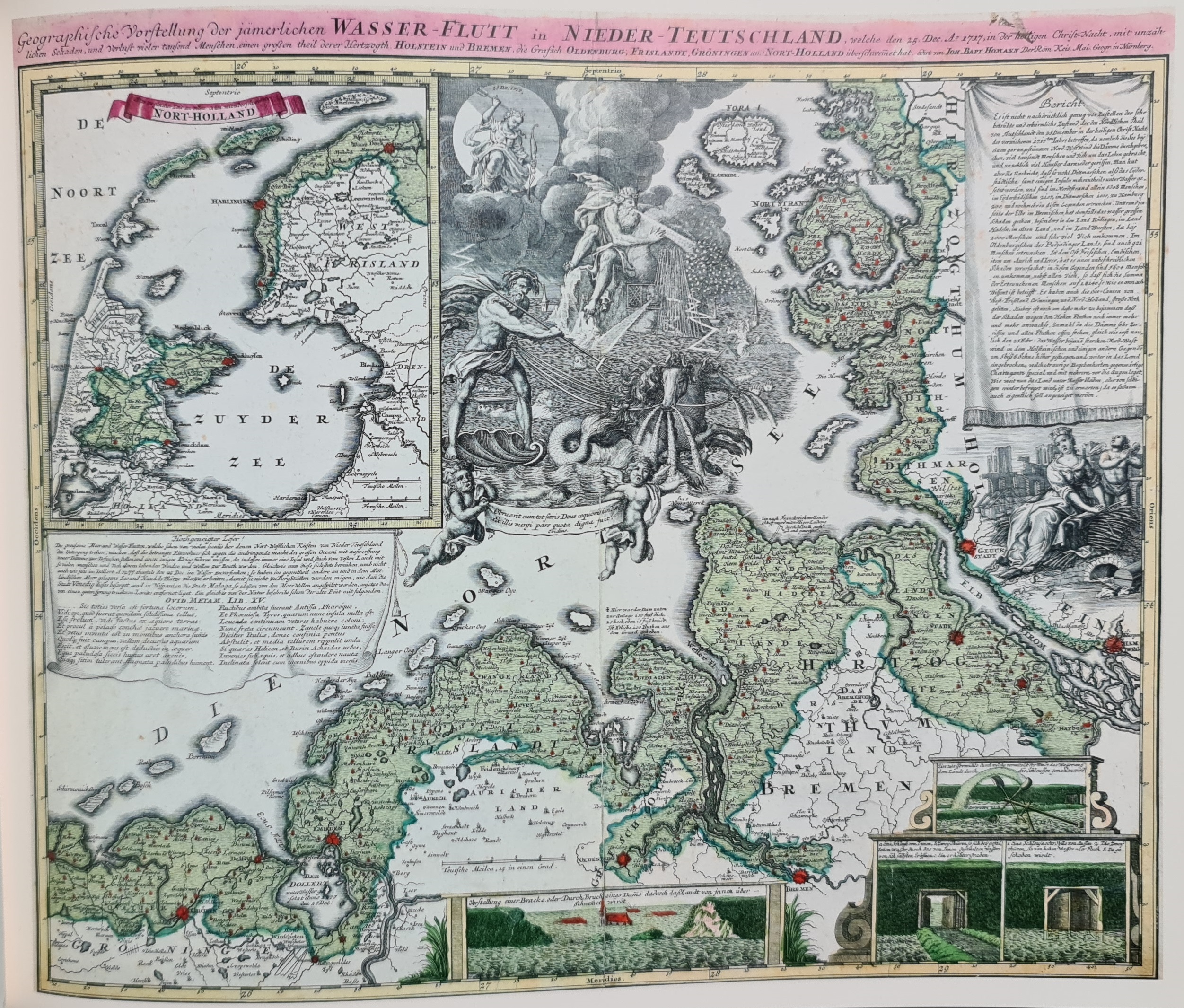
Map 1: Wasser-flut in Nieder-Teutschland by Johann Baptist Homann (1718) (a map of the areas that were flooded during the big flood of 25 December 1717)
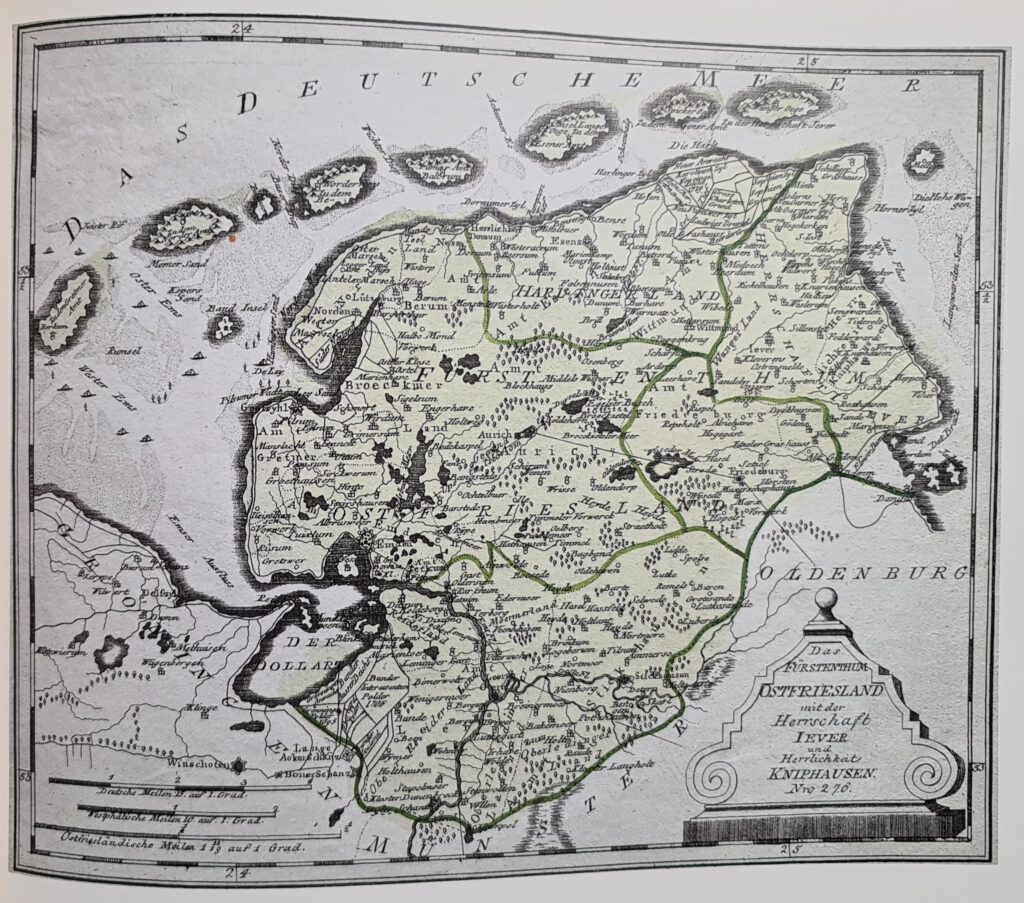
Map 2: Das Furstenthum Ostfriesland by Franz Johann Joseph von Reilly (1791)
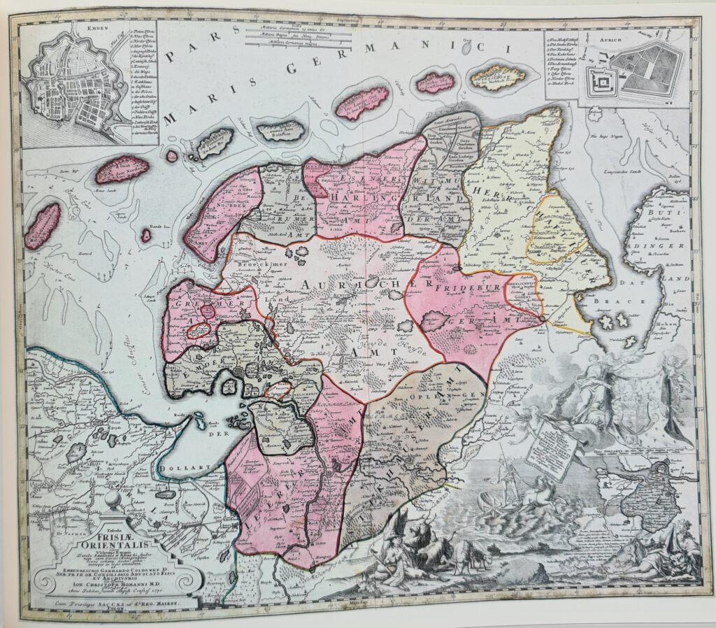
Map 3: Tabula Frisia orientalis by Ehrenreich Gerhard Coldewey (1730)